Google Maps has become an indispensable tool in our daily lives, guiding us on road trips, helping us navigate new cities, and even letting us explore far-off places from the comfort of our homes. But despite its impressive coverage, there are still places around the world that remain hidden, censored, or blurred on the platform. Whether for reasons of national security, privacy, or sheer mystery, some locations are forbidden zones that Google Maps simply doesn’t want you to see.
1. The Phantom Sandy Island
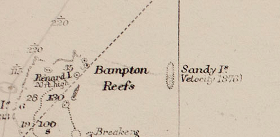
Imagine an island so mysterious that it existed on maps for centuries—until scientists discovered it wasn’t real. Sandy Island, located near New Caledonia in the South Pacific, had appeared on maps since 1774, first charted by Captain James Cook. Measuring about 15 miles long and 3 miles wide, it was even reported by 19th-century whaling ships.
But in 2012, Australian researchers sailed to the coordinates only to find open water. Following this revelation, Google Maps removed Sandy Island, leaving only a faint outline of where it once “existed.” The leading theory? Captain Cook might have mistaken floating volcanic pumice for land, creating a phantom island that persisted in cartography for centuries.
2. Amchitka Island: A History of Atomic Testing
Deep in Alaska’s Aleutian Chain lies Amchitka Island, a place with a chilling past. During the late 1950s, the U.S. Atomic Energy Commission selected it as a testing site for underground nuclear experiments. Three tests were conducted, including Cannikin in 1971, the largest underground nuclear detonation in U.S. history, equivalent to 5 megatons of TNT.
Today, much of Amchitka remains censored on Google Maps, and the area is closely monitored for radioactive contamination. By 2025, the island is set to become a restricted-access wildlife preserve. The veil of secrecy around Amchitka underscores its nuclear legacy and the ongoing concerns about its environmental impact.
3. The Infamous Area 51
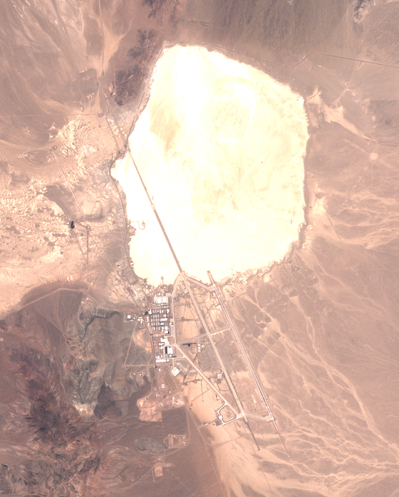
Few places spark as much curiosity and conspiracy as Area 51, the highly classified U.S. Air Force facility in Nevada. Known for testing experimental aircraft like the Lockheed U-2 spy plane, the base is famously linked to UFO lore. Reports of mysterious lights and flying objects in the 1950s fueled speculation that the government was hiding extraterrestrial technology.
Even though the CIA declassified documents confirming Area 51’s existence in 2013, much about the site remains unknown. On Google Maps, satellite imagery of the base is deliberately blurred, and attempting to use Street View humorously places users inside a flying saucer—adding to its mystique.
4. HAARP: A Magnet for Conspiracy Theories
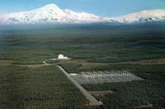
The High-Frequency Active Auroral Research Program (HAARP) in Gakona, Alaska, is another enigmatic site partly obscured on Google Maps. Funded by the U.S. military and DARPA, HAARP was designed to study and improve the ionosphere for better communication and surveillance.
While the program’s goals sound scientific, its secretive nature has made it a magnet for conspiracy theories. Critics claim HAARP could manipulate weather, control minds, or even cause natural disasters. On Google Maps, the facility appears overly bright and washed out, adding to the intrigue surrounding its operations.
5. The Fortress of Fort Eben-Emael
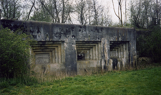
Nestled near the Belgian-Dutch border, Fort Eben-Emael was once considered an impenetrable military stronghold. Built between 1931 and 1935, the fort was meant to defend Belgium from German attacks. However, in 1940, a small German airborne unit captured the fort in a daring glider assault, marking a pivotal moment in World War II.
Today, Fort Eben-Emael’s layout is blurred on Google Maps, likely due to its strategic importance. While you can visit the site in person, its restricted digital visibility leaves much of its history shrouded in mystery.
6. Israel: The Kyl–Bingaman Amendment’s Low Resolution
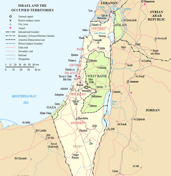
If you’ve ever tried zooming in on Israel using Google Maps, you may have noticed that the imagery becomes blurry. This isn’t a glitch—it’s the result of the Kyl–Bingaman Amendment of 1997. This U.S. law prohibits mapping services from providing high-resolution satellite images of Israel and the Gaza Strip.
The reasoning? National security. The restriction is meant to protect sensitive locations from being exposed to potential threats. Despite advances in satellite technology, this regulation keeps the region’s imagery low-resolution, even as other countries appear in stunning detail.
7. Babylon: A Historical Blackout
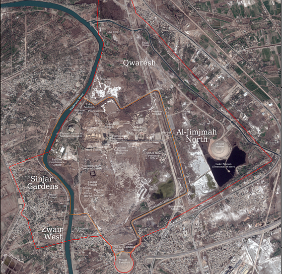
The ancient city of Babylon in modern-day Iraq is one of the most significant archaeological sites in human history. Once the heart of a powerful empire, it’s famous for the Hanging Gardens and its role in biblical texts. Yet on Google Maps, Babylon is completely blacked out.
Why? The exact reason remains unclear, though some speculate that the site’s censorship could be related to military installations or radar systems in the area. Whatever the reason, the blackout has only deepened the intrigue surrounding this historic city.
Why Are These Places Hidden?
The reasons behind Google Maps’ censorship of certain locations vary, but they generally fall into a few categories:
- National Security: Locations like Israel or military installations are blurred to prevent sensitive information from falling into the wrong hands.
- Environmental Concerns: Sites like Amchitka Island are hidden to minimize public access and protect fragile ecosystems.
- Conspiracy and Speculation: Places like Area 51 and HAARP are obscured in part due to their controversial histories and public intrigue.
- Historical Mysteries: Sites like Sandy Island and Babylon highlight how even digital tools can reflect our evolving understanding of history.
The Allure of the Forbidden
In a world where technology makes almost everything accessible, forbidden spots on Google Maps remind us that some places remain out of reach. Whether due to secrecy, security, or mystery, these hidden locations capture our imagination and challenge our desire to explore the unknown.
So next time you’re scrolling through Google Maps, take a moment to wonder—what else might be hidden just out of view? As much as we know about our world, some secrets are still worth keeping.


